We're back in the US of A, and have been for awhile. But there's still quite a bit we haven't shared from our trip, particularly our last 3.5 weeks in Europe. So we're working on that now, slowly but surely, and in chronological order. Believe it or not, we also have some posts left from Asia. But we're keeping things as organized as possible - so feel free to browse, and/or use our tags to help you find what you need. Whether you're planning a trip of your own, daydreaming of distant lands, or living vicariously through us - relax, enjoy, and happy reading!!

PS If you're looking for the details of our road trip across the US, you'll find them on our Tumblr.

Friday, January 6, 2012

Cool Kids Drive On The Left (Jan. 3 Cont'd)

As we cooled down from our run near Mount Cook, we took a few minutes to walk through a small (free!) educational display that the Mount Cook Alpine Center had set up as a tribute to Sir Edmund Hillary, a mountaineer and explorer from New Zealand.  He was the first climber to summit Mt. Everest (in 1953) - and he did much of his training on Mount Cook!  He was also part of the team that first reached the South Pole over land.  Quite the intrepid (and warm blooded!) fellow.

Smart and more aerobically fit than we were before, we set off for Te Anau, a town on the outskirts of the Fiordland National Park.  Our driving route took about 4.5 hours and looked like this:


View Larger Map

With about 2 hours remaining, I took the wheel for the first time.  I'd never been brave enough to try left-side-driving in Singapore, but the empty roads in this part of New Zealand seemed like the perfect place to try.  This worked out pretty well, actually, and I got in quite a bit of practice.  Subsequently, I've driven around Te Anau over the past few days.  A few thoughts from these experiences:

1. I have retooled all of my Driver's Ed sayings.  When I approach an intersection, I say out loud, "Look right, look left, look right again."  And I still have to stop myself from taking one more peek to the left.  I sit up very straight. I make my turns very square. I think: "Slow down into turns, accelerate out" (thanks, Mom & Dad!).  Even if it has nothing to do with LEFT side driving (but just driving in general), I'm thinking extra hard about it.

2. I may walk out to the car with every intention of driving (holding the keys, in fact), but still walk around and get in on the left.  And it's not until I'm sitting down, by myself, in the passenger's seat, that I realize my mistake.

3. I've been backing up by looking over my right shoulder (toward the window), without even thinking about it.  Kee-Min finally pointed this out to me.  Tonight, I tried to back out looking over my left shoulder (toward the center of the car).  I suddenly lost all my knowledge/instinct for which way to turn the wheel, and started trying to reason it out (on the fly).  I gave up and just looked over my right shoulder.  The brain is a crazy thing.  Why does that one small change throw off my driving intuition?

4. New Zealand likes painting the symbol for YIELD (an equilateral triangle with one corner pointing down) in the traffic lanes. This makes me panic, since a triangle painted in your lane, pointing at you, looks a bit like an arrow indicating traffic flow in the opposite direction.

5. Traffic circles are REALLY TRICKY in an opposite-side driving situation.  "Aggggh!  Which way are this cars entering? Exiting? WHERE DO I LOOK!?!?!"

6. Your turn signal is on the right now.  ON THE RIGHT!!!  Turning on your windshield wipers when prepping to make a turn just makes you look like a newbie.  Thankfully, the brake/gas orientation remain the same.  *whew*

But overall, the whole process has actually been much easier than I expected.  Thanks, New Zealand, for being so empty!  I must admit though...I'm still not ready to jump behind the wheel in Singapore.

Betsy, our trusty steed.  I have to admit, I love her (not as much as you, Dimitri!).

Wednesday, January 4, 2012

Hooker Valley Trail Run

We started the day with some rations.  Welcome to "Traveling On The Cheap":


That's free water (I won't lie...I love a country with potable tap water), free coffee/hot chocolate, raspberries from a roadside stand, and good old PB&J.  Significantly more cost-efficient that the $14-15 USD pp they wanted to charge us for continental buffet breakfast.  Food here is, generally, pricey - but these breakfasts are a total rip-off (and breakfast is virtually never included in the price of your room).

Thus fed & watered, we headed up to Mount Cook.  Aoraki/Mount Cook is the highest mountain in New Zealand (3,700 km/12,300 ft), and is part of a national park that contains more than 140 peaks higher than 2,000 meters and 72 glaciers.  That's a lot of altitude, and a lot of ice.  Mount Cook Village is near(ish) the base of the mountain, and the closest settlement/base camp/resort spot.  We drove up along Lake Pukaki.  As it was still early, there were lots of low-lying clouds.  We caught a brief glimpse of one of the high peaks (although I can't swear it was Mount Cook):


We arrived, did a quick scout of the village, and took stock.  We didn't plan to do any glacier hiking (we have a trip planned at a different spot next week), nor did we plan to pay for a helicopter ride/glacier landing.  We decided that the best way to see some of the surrounding land was to run the Hooker Valley Trail, which was purported to be about 6.5 miles, round trip.

We changed into our running clothes, topped up our water, and headed out.  The weather was spectacular, about 65 F and sun-sun-sun.  For the first 2 miles, we could appreciate the views from a distance:


We enjoyed the gravel-ly trail, had a moment of silence at the monument to climbers who perished in these peaks, and admired the view for a bit with a friendly fellow from the UK.  About 2 miles in, we came to the first of 2 swing bridges:

I could watch flowing water for hours.  It's nearly as mesmerizing (to me) as the washing machine. The view off the bridge looked something like this:  

Nature is POWERFUL.

We continued our run, across a second swing bridge and toward the glacial lake.  As the Garmin ticked 3 miles, 3.5 miles...still no lake in site.  We were starting to worry a bit, but about half a mile later, we were rewarded.


Just a bit more running, and we'd made it!  About 4 miles one way.  Quite flat along a surface that varied from very small, packed pebbles to large stones where we basically jumped from rock-to-rock.  Worth every second:

The return trip required quite a bit of people dodging/passing - but nothing that someone with plenty of Dirt and Snow Cheap experience couldn't handle.  ;-)  We finished with 8 miles total: hot, dry, thristy - and elated.

I really don't have the words to describe how incredibly gorgeous this area is - starting on Sunday's drive, the magnitude and beauty of the scenery have been phenomenal every moment.  Even the cheap rooms that we've rented have had five-star-resort views.  Everywhere I turn, nature is putting on another show.  How blessed we are to bear witness to it!


Tuesday, January 3, 2012

Christchurch to Twizel (still Jan. 1)


Despite the sobering reality of Christchurch today, the city did manage to keep us
chuckling. We found this hilarious, for multiple reasons (click to enlarge):


Before leaving Christchurch, we did manage to find an open supermarket and procure
some rations. Our first breakfast in NZ was enjoyed from our rental car, in the shopping
center parking lot. At least some seagulls stopped by to keep us company.


And New World does make a tasty muffin, even on New Year's Day. Fortified, we set
out for Twizel. Our route took us southwest on the major highways of the South
Island.


View Larger Map]


By "major highways", I mean these:


OK, that last one wasn't exactly a highway.  But we were on the highway, and that was the view.  All of this scenery was tough to watch, but hey - somebody had to do it!

Kee-Min piloted this leg of the journey. NZ is a driving-on-the-left country, and I need a
day or two to panic from the passenger's seat before I make the adjustment to the left.
He learned on the left, so I willingly surrender the keys.

Our drive took us through approximately 4 towns over 4 hours. And by 'towns', I mean
a <1 km stretch of houses, hotels, and eateries, most individually owned & operated.
Then, back to roadside vegetation/views to keep us company. The Southern Alps were
always visible on the right, and afforded us breathtaking photo ops the whole way.

We stopped at Lake Tekapo - a gorgeous glacial lake, around which a
tourist town has been built. But honestly, even the touristy areas of NZ (most of the
Southern Island, really) don't feel gaudy-touristy. Most of the establishments are small
and family owned/operated (although there are a few mid-sized hotel chains), the people are
respectful of the environment, everything is clean (no litter), and no one is showing off.
Most of them are there to relax, adventure, and appreciate the area. It's quite refreshing
to see, actually.

Lake Tekapo:


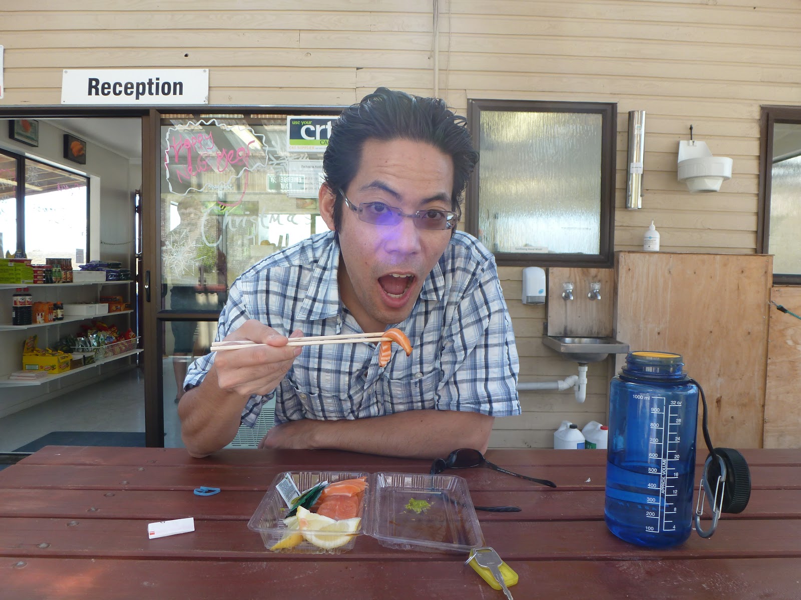
Our final stop for the day was at a Salmon Farm. Again, a small operation that
sustainably farms a limited amount of salmon in a glacier-fed canal. They were not
giving tours on Sunday, but from the edge of the canal, we could see the enclosed areas
where the salmon are kept:

 Standing quietly, we could even hear or see an occasional jump - pretty sizable
splashes, if you ask me! As two people who fully respect the tastiness of a delectable
bit of raw fish, we were happy to procure a large portion for ~$12-13 USD.

(Note: Some salmon was already eaten by the time we remembered to capture the moment.)


Yum!

Then, it was back in the car and on to Twizel for a quick run (nothing especially scenic),
snack, and bed. We had Mount Cook to see in the morning!

*Note: I'm sorry to inform you that Twizel is not pronounced like Twizzler without the 'r'.
[This was my preferred pre-departure pronunciation.] Proper pronunciation is TWIGH-
zul.